Integrated decision support system for environmental risk assessment and management

About the project

In the context of climate change, natural disasters are one of the biggest problems for countries around the world. Particular attention is paid to their impact on forests due to the ecological and socio-economic consequences of their deteriorated health, lower productivity, growth and regeneration. It has been pointed out that climate change reduces the risk of fires, erosion and flooding, which helping to secure a range of ecosystem services that forest areas provide and leads to difficulties in many areas of human life. Natural disturbances are unpredictable and uncontrollable, but with proper planning of a wide range of activities in forests and with correct, science-based decisions, disturbances can be managed to some extent and their impacts drastically reduced. The development of a Decision Support System (DSS) integrates scientific results into the general framework of measures and approaches for sustainable forest management. The basis for a DSS is to assess the risks of different natural disturbances, analyse data, methods and models, and better inform and increase knowledge about forest management, taking into account the needs and requirements of stakeholders. By integrating these three approaches into a common methodological framework, up-to-date data on the results of ecosystem research covering a considerable number of factors will provide data on changes in erosion intensity in the event of fire. Recommendations will be developed for the implementation of science-based solutions for fire and erosion risk that are applicable to the sustainable management of forest ecosystems in Bulgaria.

Project оbjective(s)

The main objective of this project is the conceptualisation and development of new methodological approaches for next-generation DSS, covering the links between forest, forest landscape management and landscape stakeholders. The focus is on the verification, evaluation and provision of tools and methods for decision-making. The results of the action will support holistic approaches to landscape planning that improve sustainable forest management, considering the full range of ESS and addressing policies and regulations across Europe. In this regard, an integrated DSS for the sustainable delivery of multiple ESS at the landscape scale includes support for the provision of resources for biotechnology-based economic activities, protection and regulation and cultural services. The starting point for formulating a DSS framework will require consideration of spatial forest information and approaches from different knowledge domains on rural areas and land use, such as agriculture, forestry, forest fires, hydrology, biodiversity-related fields and land-use change processes. A major challenge concerns the harmonisation of concepts, data sources and temporal and spatial structure of decision-making tools. Another challenge concerns the ability to introduce different perspectives on a problem of great relevance to different parts of Europe. For example, issues of land use and forest fires linked to urban sprawl are more acute in certain regions, while the protection of forests from pests and storms is more focused in other areas. The combination of data, quantitative analysis methods and problem focus forms the basis for multi- stakeholder approaches to informed decision-making. The landscape perspective brings to the fore different challenges, such as how to present and illustrate the results of different landscape management strategies, how to design multi-stakeholder processes that encompass actors from different landscape sectors (not only forestry), and how to make the results accessible to policy processes at national and European level. The last point puts the focus on governance and implementation issues. Minimizing the risk of their occurrence or reducing the damage from them is of particular importance for the proper functioning of ecosystems.

Methods and tools

The study will be conducted on the territory of pre-selected forest holdings for which there is data on fires that have occurred over the past few
years. An analysis of basic soil characteristics will be made after the fire, and they will be compared with available data before the fire. The
Gavrilovich method (EGM) for assessing the intensity of erosion will be applied, in which some of the factors are related to soil characteristics.
The selected model for assessing the intensity of erosion will also be used to determine the impact of fires on the intensity of erosion, by
applying it under conditions of an already existing fire and under conditions without disturbances. The risk of fires in nature in the selected

territories will be assessed according to the Methodology for assessing and mapping the risk of forest fires on the territory of the country
approved by the IAG (Lyubenov K., 2016) and according to the one prepared by a team of the Institute of Forestry and Agricultural Sciences
and the Sofia University of Applied Sciences. Ohridski – “Methodology for assessing the risk of natural fires”.

In addition to analyzing the risk
of natural disturbances, the impact of the fires that have occurred on soil characteristics and, accordingly, on the risk of erosion will be studied.
By applying the concept of ecosystem services, as a link between environmental benefits and human well-being, a geospatial analysis and
assessment of the provision of selected ecosystem services from the groups of material, regulatory and cultural services will be carried out. The
results obtained will be visualized through maps, using the capabilities of geographic information systems. In this way, territories are determined
in which it is necessary to apply forestry measures to reduce the risk of natural disturbances as a priority.

Implementation Plan / Project Activities

 Activity
1Analysis of data on fires and erosion processes in pilot areas
2Application of the EPM model (Gavrilovich) for erosion assessment before and after fire
3Assessment of fire risk by applying the established methodologies (IAG and IG-BAS/SU)
4Research of ecosystem services in a post-disturbance environment (degradation processes, such as fire or erosion) (GIS analysis)
5Participation in meetings and workshops of WG1 and WG2 (assessment of ecosystem services, DSS models)
6Development of recommendations for sustainable risk management and integration into DSS
7Publication of results in joint scientific articles and participation in conferences
8Preparation of a national report with recommendations for forest policy
  Activity Months
   
123456789101112131415161718192021222324
1 Analysis of data on fires and erosion processes in pilot areas
2 Application of the EPM (Gavrilovich) model for erosion assessment before and after fire
3 Fire risk assessment by applying the established methodologies (SFA and FRI – BAS/SU)
4 Study of ecosystem services in a post- disturbance environment (degradation processes, such as fire or erosion) (GIS analysis)
5 Participation in meetings and workshops of WG1 and WG2 (assessment of ecosystem services, DSS models)
6 Development of recommendations for sustainable risk management and integration into DSS
7 Publication of results in joint scientific articles and participation in conferences
8 Preparation of a national report with recommendations for forest policy

Team

Host Organization: Forest Research Institute – Bulgarian Academy of Sciences
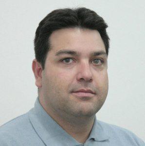
Chief Assistant Professor Todor N. Stoyanov, PhD – Project Manager

Dr. Todor N. Stoyanov is a researcher at the Forest Research Institute of the Bulgarian Academy of Sciences. His research focuses on wildfire risk assessment and management, economic loss evaluation, ecosystem services, sustainable forest management, forest policy, bioeconomy, and decision support systems (DSS). He is the author of the monograph “Forest Fires – Legislation, Management and Prevention” and numerous scientific publications related to wildfire governance, forest economics, circular bioeconomy, and sustainable natural resource management. He actively participates in international research networks and projects, including COST Action DSS4ES, EASAC initiatives, and several European and national research programs. His current work focuses on the development of integrated frameworks for wildfire risk assessment, economic loss valuation, ecosystem services analysis, and decision-support tools for climate-resilient forest governance and sustainable land management.

Assoc. Prof. Dr. Eli Pavlova-Traykova - Team Member

Assoc. Prof. Dr. Eli Pavlova-Traykova Forest Research Institute – Bulgarian Academy of Sciences Scientific and professional qualifications: Assoc. Prof. Dr. Eli Pavlova-Traykova is a specialist in the field of soil science, soil degradation and erosion processes in forest ecosystems. She has many years of experience in: - Analysis of soil characteristics and processes after natural disturbances (fires, landslides, erosion); - Use of GIS technologies and spatial models for analysis of landscape and ecological changes; - Application of methods for assessing ecosystem services related to soil fertility, water retention and erosion protection; - Participation in interdisciplinary scientific teams on projects funded by the National Park "Science and Education", the National Science Foundation and international programs: She has publications in specialized scientific journals, as well as experience in fieldwork in various types of forest ecosystems in Bulgaria. Role and responsibilities in the EcoRiskGuard project: - Conducting soil studies in fire-preserving territories; - Collection and interpretation of soil samples, incl. preparation for laboratory processing; - Application of the Gavrilovich model (EPM) for quantitative assessment of erosion risk; - Participation in GIS analyses and spatial modeling of ecosystem services; - Support in preparing maps and reports, as well as participation in scientific publications and presentation of results.

Chief Assistant Professor Rositsa Yaneva - Team Member

Chief Assistant Professor Rositsa Yaneva is an expert in the field of forestry, ecosystem analysis and spatial modeling. Her scientific experience includes: - Research on restoration processes in forests after natural disturbances – fires, windstorms, droughts; - Work with geographic information systems (GIS) for the needs of forest planning and management; - Application of models for forecasting forest risks and assessing ecosystem services; - Experience in intersectoral cooperation with forestry, environmental and governance institutions. Author and co-author of scientific publications in the field of sustainable forest management and integrated assessment of environmental risks. Role and responsibilities in the EcoRiskGuard project: - Collection, structuring and analysis of spatial and statistical data related to fire risk; - Implementation of the Methodology for assessing and mapping the risk of forest fires (IAG, 2016); - Participation in the implementation of the ERM model for assessing erosion hazard; - Creation of GIS maps and visualizations of risk areas; - Co-authorship in developing recommendations for sustainable management and scientific publications.

Publications and results

Enter description text here.Lorem ipsum dolor sit amet, consectetur adipiscing. Quo incidunt ullamco.
Scroll to Top